During our 2018 series on The Current Status of Kenya’s Bird Atlas, many of the major gaps in coverage that were highlighted appeared very difficult to reach due to their remoteness. Kenya is, however, a rapidly developing country and there is a fairly decent road network in most parts of the country today. These roads can be used to get to many places that were once almost inaccessible.
Due to Kenya’s huge diversity in habitats, altitude and landscape overall, the country’s major roads can be used like transects to collect records on the species of birds that occur in these varying habitats. A good example is the Nairobi-Mombasa road. If all the pentads along this road were atlassed, it would be possible to get a pretty good picture of the changes in bird species composition from above 1600m (Nairobi) to sea level (Mombasa). This is a very basic example but I hope you get the idea. This can be done for almost every major road across Kenya as they all almost invariably pass through several different habitat types. The BirdLasser app makes it easy for you to know which pentad you are in and to explore the map in satellite mode for smaller roads/tracks (and different habitats) that you can explore within the pentad.
There are very many unmapped pentads along Kenya’s roads. Here are some of them:


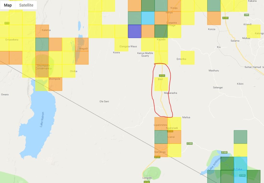

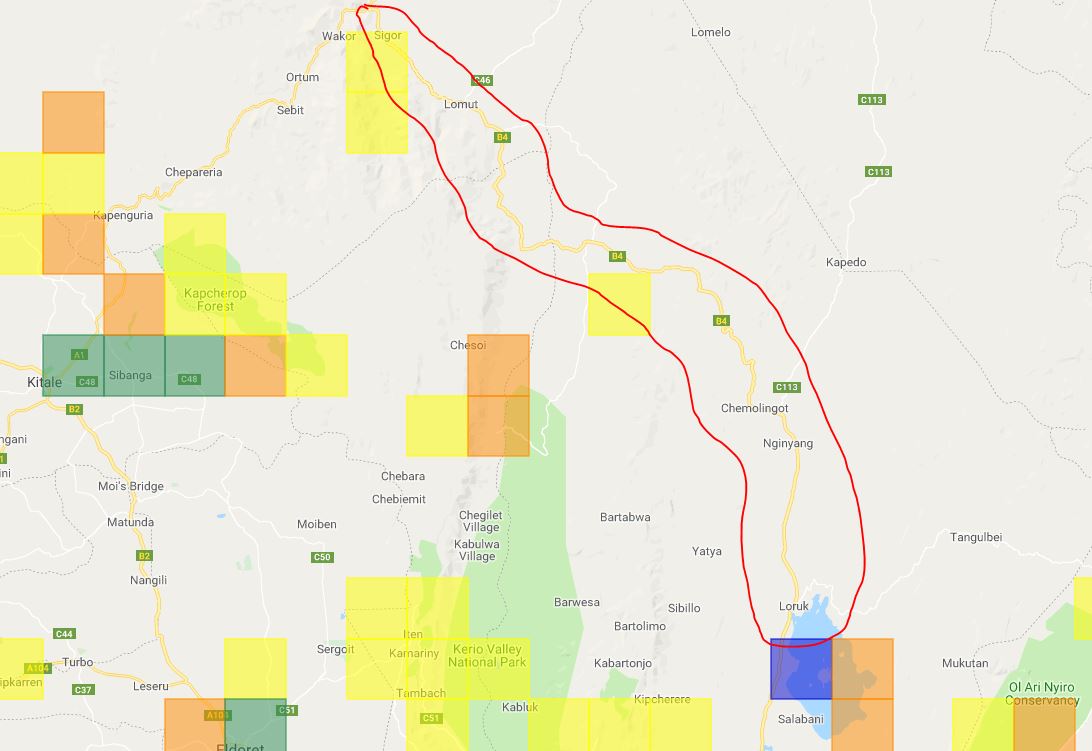
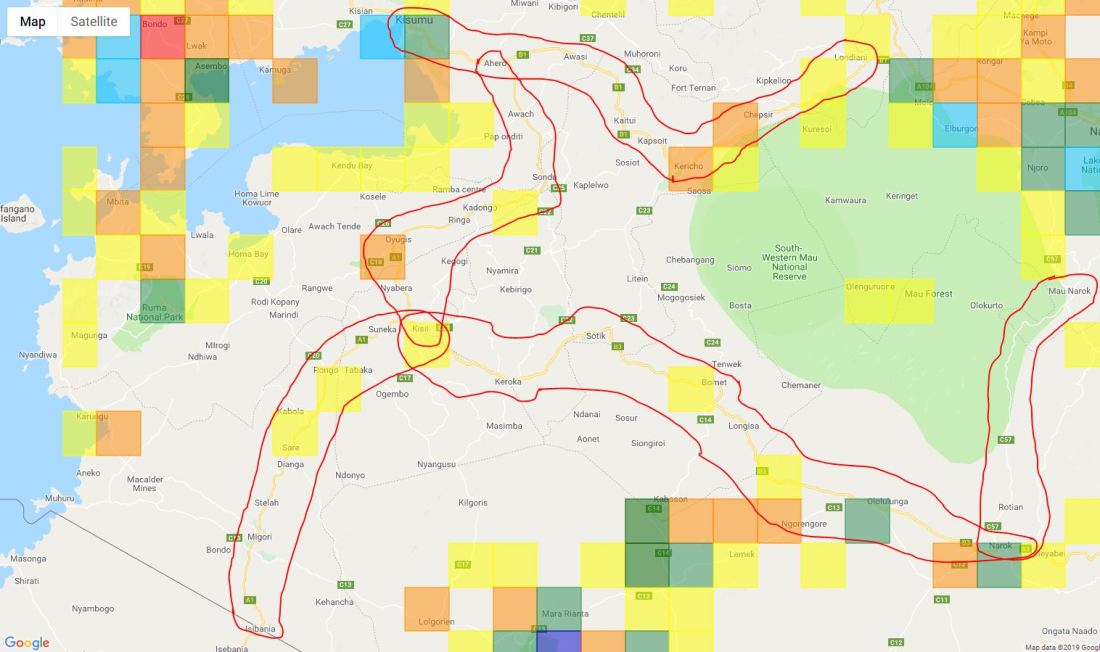
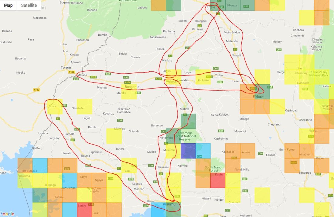
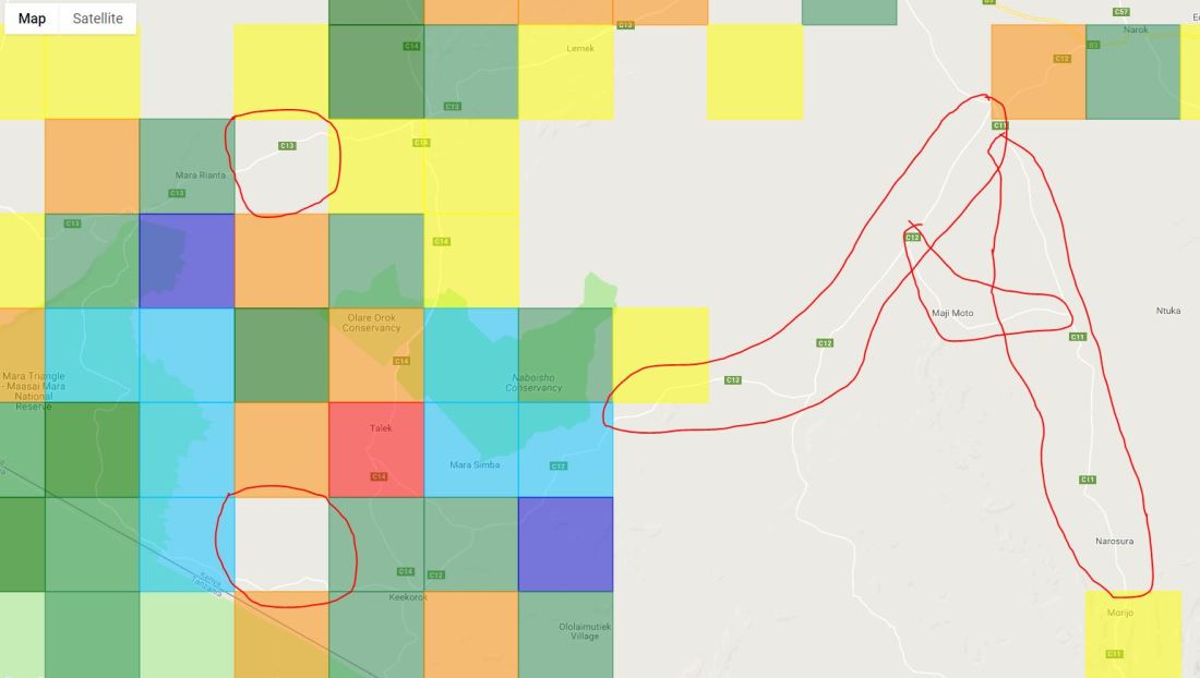
There are several other gaps that you can find by checking out the Coverage Map on the Kenya Bird Map website. Remember that in order to color a pentad, you must complete and submit a full protocol list. Ad-hoc lists do not add color to the pentads on the map.
Come on Kenya Bird Mappers, let’s use Kenya’s well-established road network to substantially increase the coverage of the country. Some roads (especially those in the north-east) may pose challenges due to security risks, but most are fairly safe as long as you let the local people know what you are up to. Before we even start worrying about the insecure roads, there are still many safe and easily accessible ones that have big gaps. And the good thing is that many can be reached via public transport, so you don’t necessarily need to have a vehicle.
Feel free to contact kenyabirdmap@naturekenya.org if you have any questions or are experiencing any challenges while atlassing.
– Author: Sidney Shema (Project Manager – Kenya Bird Map) –

Awesome stuff. Still wish I have a smartphone.
On Fri, Jan 18, 2019 at 12:33 PM Kenya Bird Map Blog wrote:
> kenyabirdmap posted: “During our 2018 series on The Current Status of > Kenya’s Bird Atlas, many of the major gaps in coverage that were > highlighted appeared very difficult to reach due to their remoteness. Kenya > is, however, a rapidly developing country and there is a fairly de” >
LikeLike